-
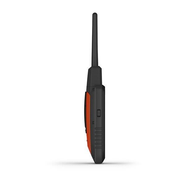
6.8 x 16.2 x 3.4 cm *dimensions do not include antenna
-
280.00
-
Rechargeable lithium-ion
-
Up to 20 hours; up to 15 hours with inReach® technology enabled
-
TT 15/T 5, 14.5 km; TT 15 mini / T 5 mini, 6.5 km
-
282 x 470 pixels
-
Transflective, color TFT touchscreen
-
High-speed USB
-
IPX7
-
-
On top, black
-
N/A
-
N/A
-
N/A
-
N/A
-
VHF
-
N/A
-
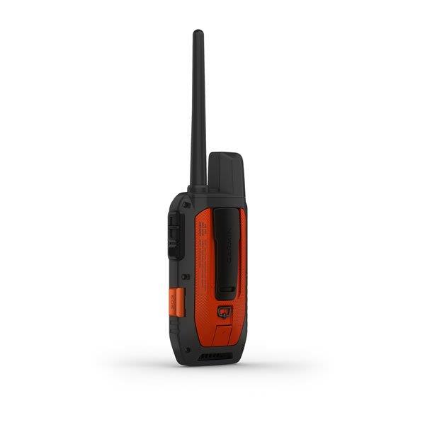
Alpha® 200i handheld with rechargeable lithium-ion battery pack Belt clip AC adapter microUSB cable Documentation
A STRONG INTERCONNECTION IN A STRONG CONNECTION
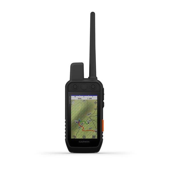
Monitor and train dogs with the Alpha 200i system with inReach®1 technology, a sunlight-readable 3.5 ″ capacitive touch screen and a user-friendly six-button system.
- This system is designed to make tracking the location of dogs and training them simple, easily accessible and fast.
- Follow your animals and train them while they are outdoors.
- Keep dogs that are not currently participating in activities in the system of the device for easy setup and management!
- InReach technology helps keep animal information up to date when mobile phones fail (requires an active satellite subscription) 1.
- Navigate every hunt with the best of Garmin mapping and sensors!
- The user-replaceable battery lasts up to 20 hours and up to 15 hours with inReach technology enabled.
- Choose to follow the dogs and train them to a much more complete level!
FOLLOW YOUR ANIMALS!
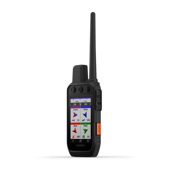
Monitor up to 20 dogs up to 14.5 km (depending on the dog device) in 2.5 sec. location update intervals.
LIST OF DOGS / GROUP MANAGEMENT
Keep the currently inactive dogs on the list and manage the active groups so that you do not have to add or remove dogs for each hunt.
HUNTING DATA
View each dog's daily hunting habits, distance and speed to monitor their performance and prevent overheating. Pair with TT ™ 15 tracking and training collars.
SIX - BUTTON SYSTEM
Use the special buttons to quickly make training instructions and make small adjustments when you're outdoors!
18 STIMULATION LEVELS
The possibility of performing one-time and continuous stimulation allows to adjust the training to each dog individually.
SOUND AND VIBRATION
Use different levels of sound or vibration commands to quickly correct the behavior of individual dogs!
APPLICATION GARMIN EXPLORE ™
Pair with the Garmin Explore app on your compatible smartphone to see real-time dog tracking information, save lists of dog tracks, and play those tracks for an accurate view of what happened during the hunt.
OPTIONAL INREACH WEATHER FORECASTS
Use the inReach connection for detailed weather information on the Alpha 200i or a compatible device paired with Garmin Explore. Request weather forecasts for your current location, stops along your route, or your destination.
″ PRO VIEW ″ COMPASS
Pro view compass mode offers easy and instant tracking, indicating which direction and how far away the dogs are from you, and you can see when the dog is in the lurch or starting to heal.
Navigate nearby!
MULTIPLE GNSS SUPPORT
Access multiple global navigation systems (GPS and Galileo) to track your animals with more precision than just GPS!
TOPOACTIVE EUROPEAN MAPS
Our pre-loaded TopoActive Europe map provides detailed views of terrain, topography, peaks, parks, coastlines, rivers, lakes and geographies.
BIRDSEYE DIRECT
Download BirdsEye satellite imagery directly to your portable device for realistic views of your route, transitions, clearings and more.
NAVIGATION SENSORS
The barometric altimeter helps you accurately track the rise and fall of air pressure and see temporary changes in pressure, and the built-in three-axis electronic compass with tilt compensation shows you the direction you need, whether you're standing still or on the move.
SEE IT ALL!
The sun-readable 3.5 ″ capacitive, touch screen makes it easy to view and manage maps, dog data and other information, even when you have gloves on.
BE ON THE MOVE!
The replaceable battery lasts up to 20 hours or up to 15 hours with inReach technology enabled.
ADDITIONAL MAPPING
The microSD card slot allows you to use an even wider range of cards, such as TopoPro cards (sold separately).
Stay in touch with inReach technology!
TWO - WAY MESSAGE
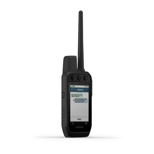
Send and receive text messages to your loved ones, post on social networks, or connect with other inReach devices outdoors from your inReach device (requires an active satellite subscription) 1.
INTERACTIVE SOS SIGNALS
In an emergency, activate the sending of an interactive SOS message to the Garmin IERCC, a professional, 24-hour emergency response coordination center (requires an active satellite subscription).
LOCATION SHARING
Keep track of your location and share it with the rest of you or those who travel like you, so they can see your progress on the trip or search for your device to determine your GPS location (requires an active satellite subscription1)!
100% GLOBAL IRIDIUM® SATELLITE NETWORK
You no longer have to rely on mobile network coverage - now your messages, SOS signals and tracking data are transmitted over the global Iridium satellite network (requires an active satellite subscription) 1.
